Szardínia - térkép és földrajz

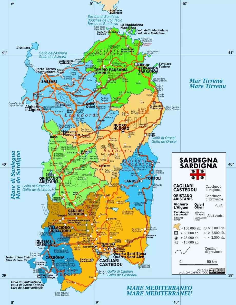
Want to see where Sardinia is on the map? What does a road map of Sardinia look like or where can you find interesting places to see? Take a look at the maps of Sardinia we have prepared for you.
Find the best beach resort in Sardinia
Location of Sardinia
The island of Sardinia lies in the Mediterranean Sea, washed by the Mediterranean and Tyrrhenian Seas. Part of Italy, it is its 2nd largest island, separated from the French island of Corsica by just a few kilometres of the narrow Strait of Bonifacio. From the entire northern coast, the shores of Corsica can be seen on clear days.
Maps of tourist attractions
Where can you find the best beaches or interesting sights in Sardinia? Simply take a look at our map of top tourist spots:
If you're planning on hiking or cycling, the online maps of hiking routes will come in handy, and of course there's no shortage of accommodation and hotel maps:
Online map of Sardinia
Downloadable maps
Prefer offline map downloads? The ideal option is offline maps from En.mapy.cz or Maps.me, which you can simply download to your mobile phone and use anywhere without additional data consumption.
Also check out the simple offline road and highway map of the island:
Van még kérdés?
Ha bármilyen kérdése vagy észrevétele van a cikkel kapcsolatban...


